As promised, a cold front moving through the region is bringing with it strong thunderstorms, hail, damaging winds, and tornados.
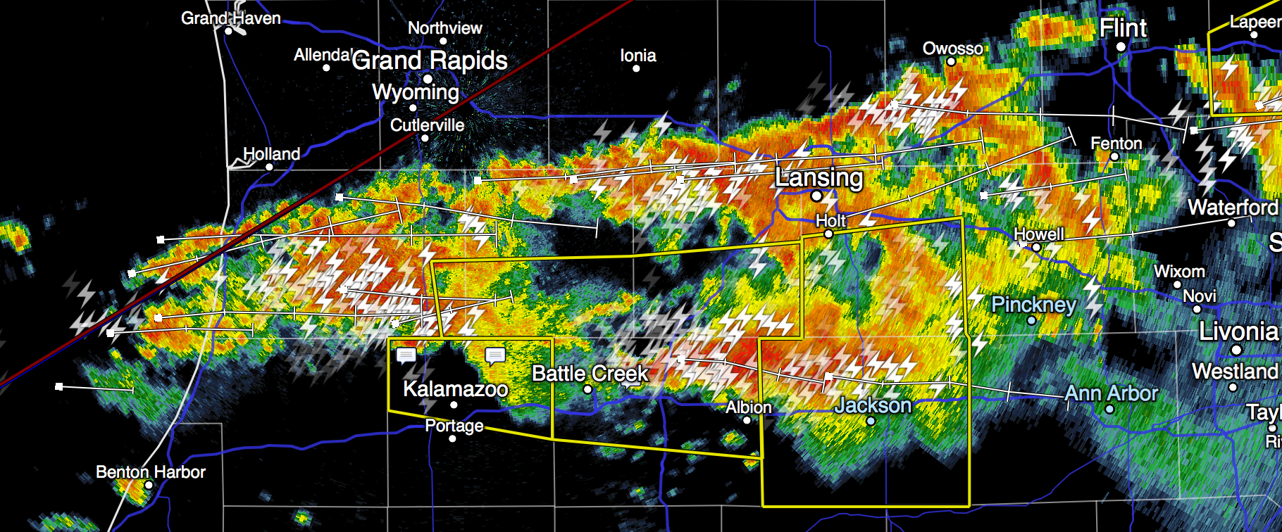
A powerful line of storms (radar image below) stretches from Jackson west to northwest of Kalamazoo, and the humid air will continue to fuel storm development until 1 or 2 am.
The storm currently over Jackson is currently severe-warned and will continue toward Ann Arbor in the next 30-40 minutes. It appears to be weakening very slightly, but severe activity behind that continues to move east toward us.
It does appear that the furthest-west activity is slightly north of Ann Arbor and if it continues due east, it ought to remain mostly over Livingston County. But it is too early to say that with certainty; there’s plenty of warm, humid air to go around, and it appears that storms are forming along I69 between Coldwater and Marshall; if those continue to develop they’ll certainly hit us.
It is hard to predict with certainty whether any of these storms will be severe when they hit us. But we will see some strong storms in Ann Arbor tonight. Generally speaking, they will come with lots of lightning, some hail, and strong (possibly damaging) winds. Rain will be moderate, heavy, or locally torrential.
Storms ahead of this front have earlier produced strong low-level rotation and possible tornados, and a tornado watch remains in effect until 3am. Where the front north of M59 produced many severe cells and tornado warnings, it does appear the storms headed toward us are less happy to produce strong rotation, but of course this could change and we should remain alert until the tornado watch is cancelled.
Tune to local emergency broadcasters for reliable updates. (Follow ArborWX too, but ArborWX might fall asleep.)